Ku Ku KaChew

Welcome to the world of Ku! This was originally a food blog, but I am turning it into a general collection of my life experiences :)
If you're looking for my raw food blog, you can find it here: http://atlantarawks.blogspot.com

Thursday, January 23, 2014

A day of WEIRD

Before my weird day today, I had a phenomenal dinner with my cousin, Arielle, in Irvine, CA. I discovered this restaurant (Taiko) when I was in Irvine last January for work. My favorites are the tuna, salmon, yellowtail, and eel. It's the creamiest, meltiest, most succulent sushi I've ever had, including sushi from Kyoto, Japan!

This was actually from a couple days ago during the drive from Bakersfield to Irvine. See those long pipes going over the mountain in the distance? Pretty sure those are oil pipes. Goodness.

Wind mills! Much better and prettier than oil rigs!

Made it to Salton Sea! Ok, so let me tell you about this place... The Salton Sea is a rift lake located directly on the San Andreas Fault. Like Death Valley, Salton Sea is below sea level. Salton Sea is the largest lake in California.
The Salton Sea was actually accidentally created. Back in 1900, the California Development Company began construction of irrigation canals to divert water from the Colorado River into the Salton Sink. Due to heavy rainfall and snowmelt in 1905, the Colorado River flooded and filled up the Salton Sink, creating the Salton Sea.
The salinity level is higher than that of the Pacific Ocean, but lower than Utah's Salt Lake.

There used to be a variety of fish that coexisted in this sea. However, now only tilapia can tolerate the high salinity levels. So, when the fish die, they have no where to go but to wash up on the beach. The beaches of Salton Sea may look like gravely sand, but nope. It's a beach of bones and barnacles. And there are dead fish all over the place. HOW LOVELY!!

Tons of birds have been spotted hanging around the Salton Sea. It's a major resting stop on the Pacific Flyway during migration.

Dead fishies.... Thank goodness I was here in the wintertime (although it was still close to 80 degrees) and not in the high heat of the summer when all of these fish would be smelling SUPER RIPE.

I don't know what compelled me to come here, but I actually find shots like this strangely.... I dunno... "pretty"? *Shrug* Ima blame my artsy side. Thanks, Mama Ku!!


Mama Ku also gets blamed for this. She has skulls and bones in her studio from which to draw, and I find that I am drawn to them as well (see what I did there?). I filled a bag full of bones and barnacles from the beach. I have developed a habit of collecting shells, rocks, moss, wood, etc from my travels to build terrariums; and these bones and barnacles will not be left out! Yes.. I know I'm weird...

Pretty!

Below sea level

Still pretty!

After the Salton Sea, I came across this little cultural gem. A guy named Leonard Knight came to this area near Niland, CA in 1984. He first came here to launch his hot air balloon. After that didn't work, he felt called to create Salvation Mountain. He initially created this mountain using concrete, which was too heavy for the mountain and it did not last. So he then used adobe (a mixture of dirt, straw, and water) and water-based latex paint. While it doesn't rain much here, every time it does rain, the structure has to be renovated. Leonard is now 82 years old and living in a long-term care facility for dementia. He established Salvation Mountain as a 501c3 Charitable Organization.
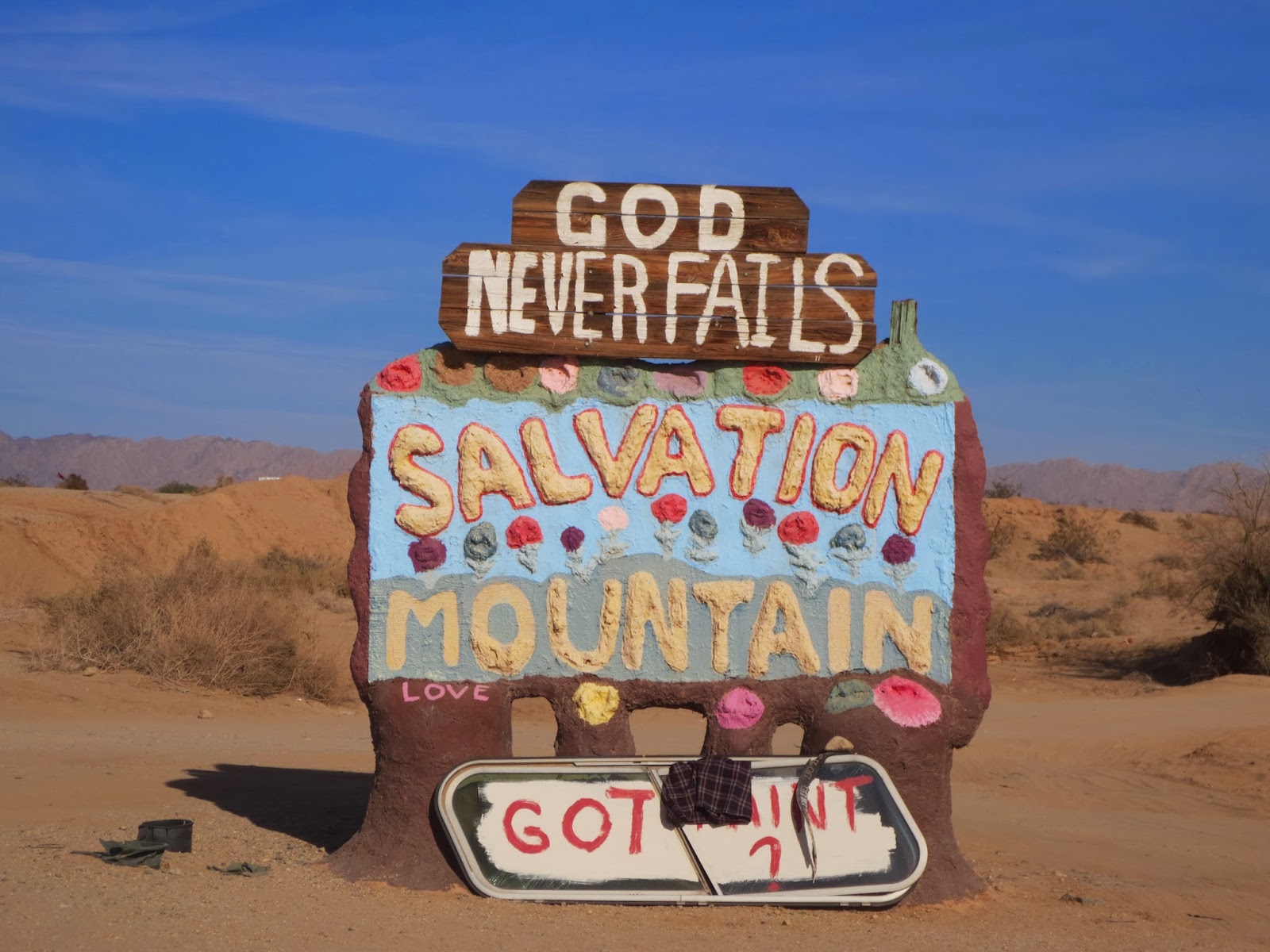


Leonard built these trees using stacked tires as the base and collected wood from around the desert for the branches. He put adobe around the tires and to connect the branches to the tire base. Pretty creative guy! This structure (which is to the right of the mountain) is the recreation of his hot air balloon out of adobe. It felt like Alice in Wonderland in here!

You can walk along the yellow brick road to go up the mountain

View going up the yellow brick road

View from the top of Salvation Mountain. This is the back view which overlooks Slab City, an area of concrete slabs that remain from the abandoned World War II Marine barracks of Camp Dunlap. Slab City is now an area where squatters live!

Here is the view from the top of Salvation Mountain looking towards the front.


View coming down the mountain

What an interesting and strange day it was! Tomorrow I'm off to Phoenix, Arizona to see my wonderful friend, Shep! I can't wait :-D

Tuesday, January 21, 2014

Sequoias

Went to Trader Joe's this morning for snacks before heading to Sequoia National Park. A fellow shopper tapped me on the shoulder and said, "Happy new year" as he handed me this flower! What a nice way to start the day! :)

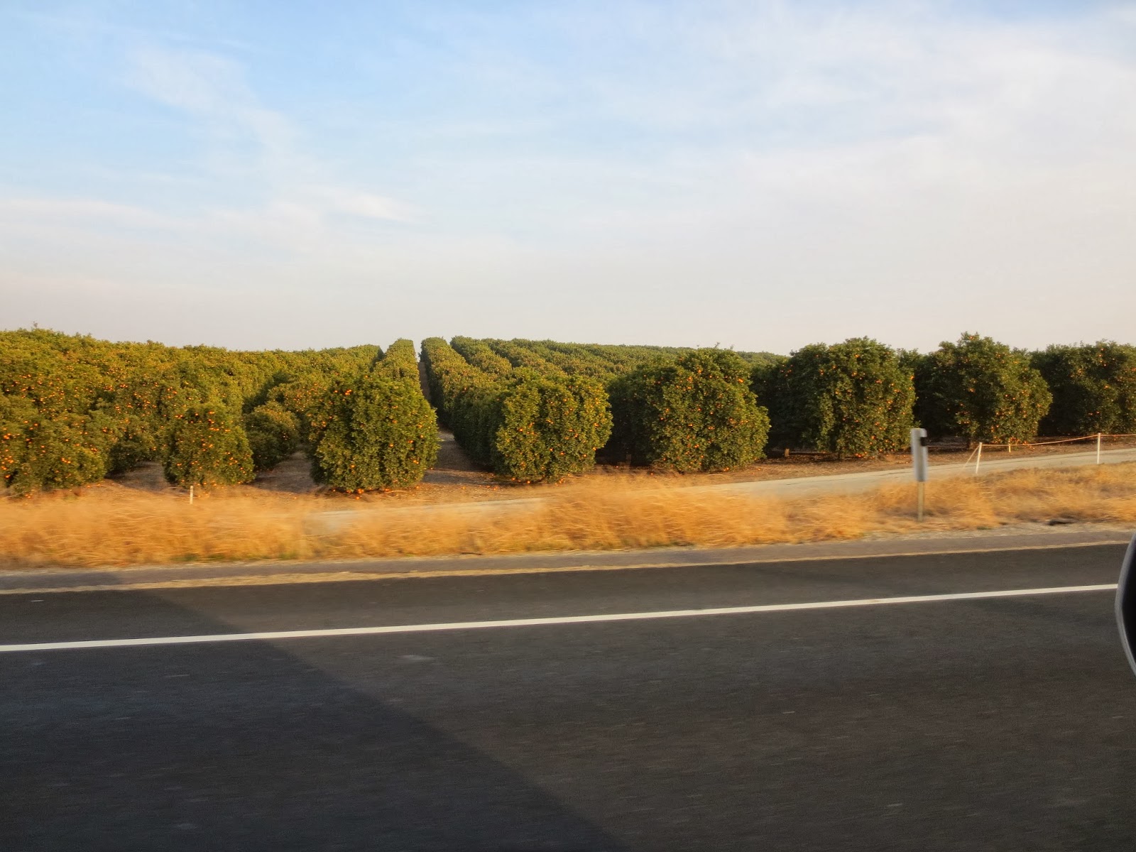
Passed a ton of orange farms on the way to the park

Snagged a couple that had fallen :)

Palm trees along the road

Made it!

This was a rock tunnel on a foot path, not for cars. I saw a deer right after this but wasn't able to stop to grab a pic.

Awesome shot with "God clouds" hah #Ben

Such pretty scenery

Love these layered mountains! I kinda like that the road is in this shot.

Lots of layers

Steep mountain

Layerrrrrrrsssss ahhhh

Fun fact: The word "sequoia" contains all 5 vowels :) [y doesn't count]

The black split areas on sequoias are scars from fires

A fallen sequoia in which a tunnel was bore (is that proper grammar?)

Tree tunnel! See the center of it on the left side?

General Sherman is the largest (by volume) tree ON EARTH!! Also kinda cool that my matriarchal genealogy has some Shermans in there somewhere!

General Sherman

Some smaller sequoias

General Sherman with some people in front for better scale. Trust me, it's big.

Not General Sherman, but how pretty is this one?

Cross-section of a sequoia

Check out that ant for a scale of the rings. This tree was >2,000 years old!

Playing with angles


Gives a little perspective

There were lots of holes in this bark, I believe from carpenter ants. Looked pretty cool. Sequoias have special bark that have tannins, making them somewhat fire-resistant. They also don't have much sap, so they are not nearly as flammable as most trees.

Fires generally happen towards the tops of mountains, so the uphill sides of sequoias get burned during fires. This is one of the reasons why sequoias tend to fall uphill. Also, while sequoias' roots are very long and extensive, they are extremely close to the surface of the ground and do not run very deep.

Super burned tree. It looked like there was wire mesh around it, but it's actually just the texture of the charred bark.

So red!

Mature red sequoias on the left, young sequoias on the right covered with chartreuse moss

I decided to have a photo shoot with this special sequoia!

Long, deep scar from a fire. Poor sequoia :(

Oh hai!

My armspan was tiny compared to the width of this guy!

Beautiful

I love you, sequoia!!

Dear sequoia, I wish I could climb you and hide in your top branches :)

Tree hugger :-D

If you look closely, you can see that it looks like two trees at the top, yet one tree at the bottom. That's because two sequoias grew so close together that they fused bases!!

Fallen sequoia in front of a pretty red one

Better view of the two trees that fused into one at the base

Driving through the forest

I can't get enough of these layered mountains!

More orange trees

WHOA look at all the oil rigs. This was north of Bakersfield, CA in an area called Oildale (surprise surprise). Seriously, click on the picture to zoom in, there are at least 15 of them just in this shot! Shouldn't gas be cheaper out here??!

Ok, so despite ending the day with oil rigs (and filling up the Pilot hah), I had an absolutely amazing time with the sequoias today :) I love having the chance to explore nature on this trip, and there are definitely wonderful things to see! Tomorrow I'll be back down around Los Angeles for a couple of days before heading to Phoenix. There probably won't be many pictures until after the weekend so I will wait to post again, but I think I've shared enough pictures the past couple of days to make up for it ;) Thanks for checkin in!